GNSS Basics for Beginners in Drone Mapping I think it is fair to assume that a significant number of drone owners have very little grasp of the importance of, and the role that Global Navigation Satellite Systems (GNSS) are playing in assisted flight and automated navigation. The reliability of orientation sensors, GNSS, powerful computers […]
Continue readingCategory Archives: Modelling
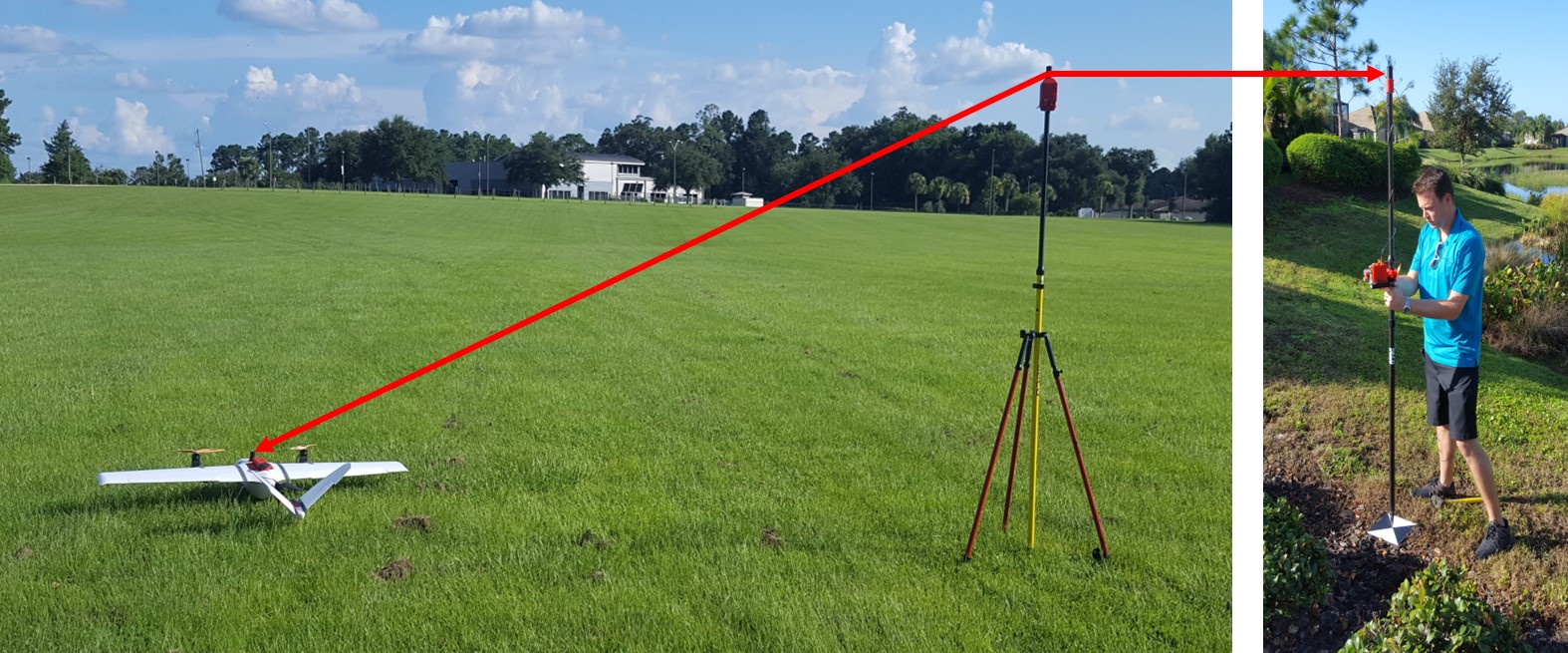
Drones, Dual Frequency GNSS, SfM and Property Surveys
In April of 2017, Walter Volkmann (President – Micro Aerial Projects L.L.C.) gave a presentation at Harvard University for the Harvard Humanitarian Initiative and Center for Geographic Analysis on the use of Dual Frequency GNSS and the Structure from Motion (SfM) technique. As a seasoned land-surveyor, Walter has worked around the globe on various mapping projects for private […]
Continue reading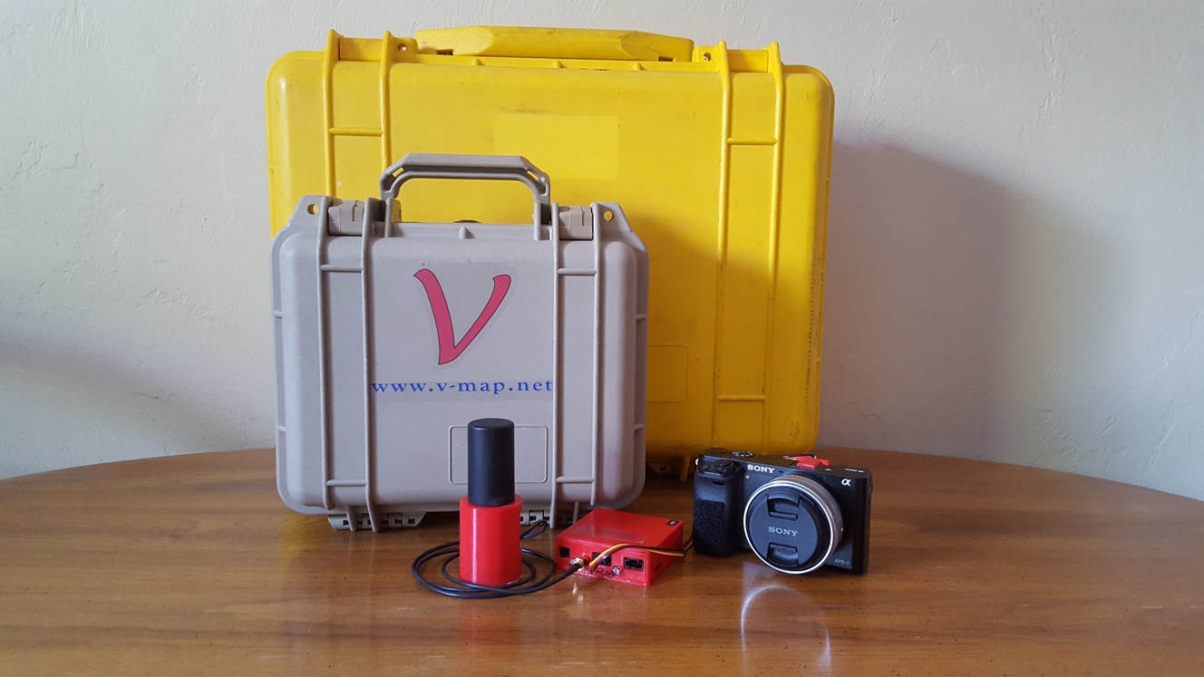
National Mapping and Resource Information Authority (NAMRIA) of the Republic of the Philippines certifies and registers V-Map receivers as suitable for “first order geodetic control positioning”
The National Mapping and Resource Information Authority (NAMRIA) of the Republic of the Philippines has certified and registered V-Map receivers as suitable for “first order geodetic control positioning”. It is not with surprise, but with considerable pride that we share with you the news that the National Mapping and Resource Information Authority (NAMRIA) of the […]
Continue reading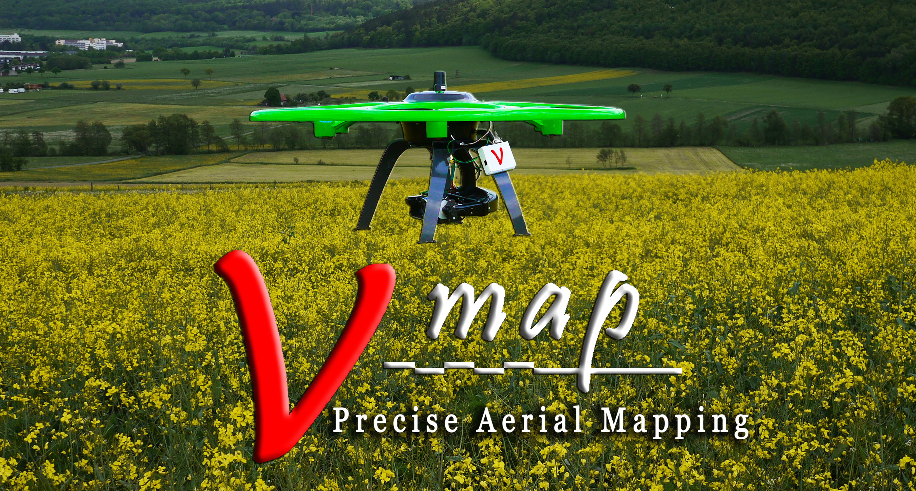
DUAL FREQUENCY GNSS ON MULTICOPTERS – SETTING THE RECORD STRAIGHT
THE HISTORY OF DUAL FREQUENCY GNSS ON MULTICOPTERS – SETTING THE RECORD STRAIGHT V-Map mounted on a modified Steadidrone The light weight dual frequency on board GNSS system for sUAVs was first conceptualized in September 2011 when we were once again frustrated by proprietary VTOL UAS manufacturers whom we could not convince of the advantages […]
Continue reading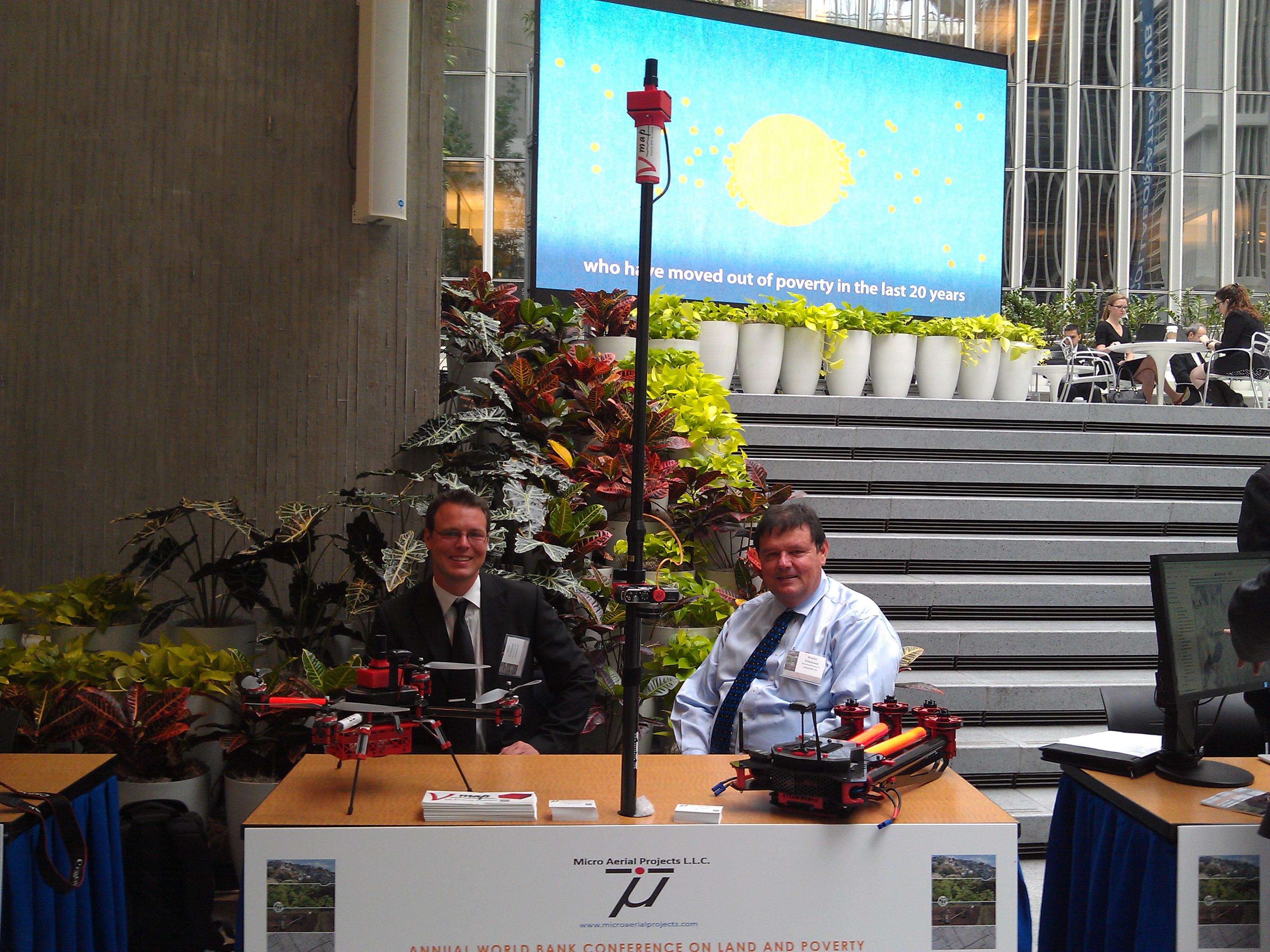
Micro Aerial Projects third World Bank Conference
Micro Aerial Projects third World Bank Conference Three years ago (2013), Micro Aerial Projects L.L.C. first attended the World Bank Conference on Land and Poverty giving a paper with Dr. Grenville Barnes of the University of Florida and Kevin Barthel of the Land Alliance titled “Using Unmanned Aerial Vehicles (UAVs) to democratize spatial data production: […]
Continue reading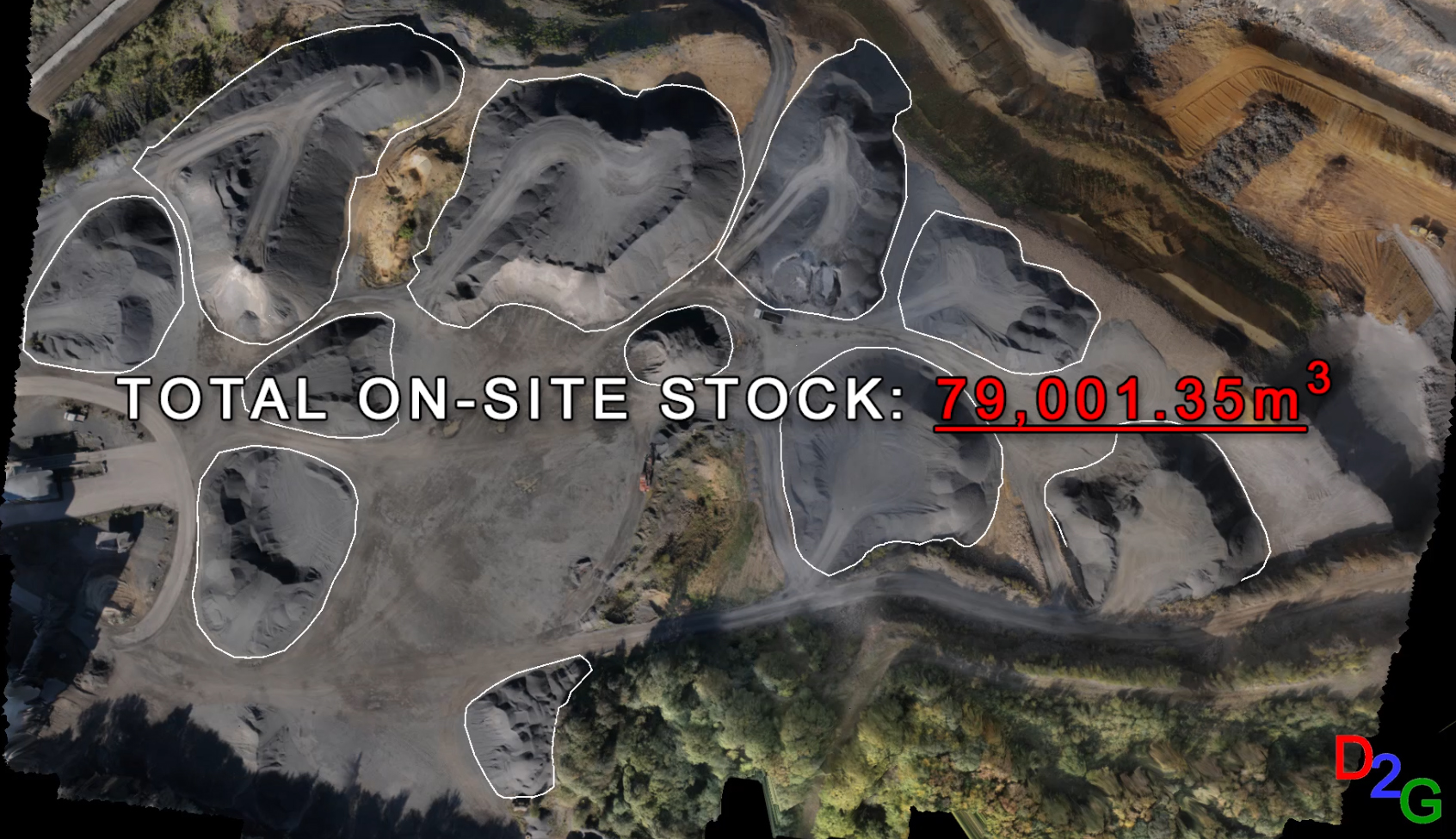
Surveying with drone2GIS Inc.
Drone2GIS offers a safe, efficient and accurate alternative approach to the conventional surveying method employed in open cast mines, quarries and stock yards for data acquisition. Through the employment of Unmanned Aerial Systems, Drone2GIS delivers precise, high accuracy ortho-photos, digital terrain models and virtual realities. With these products, we can extract features and positions to […]
Continue reading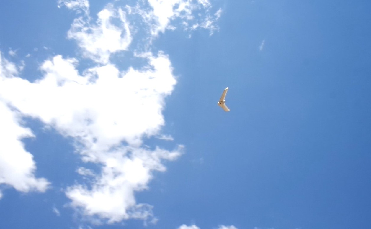
SNEAK PREVIEW OF A NEW SPECIES RECENTLY SIGHTED IN THE AMERICAN SKIES
A new species recently sighted in the American skies… Name: Bateleur (belongs to the Pixhawk family) Color: White with yellow wingtips, distinctive black spot on chest Habitat: Over fields, farms and towns anywhere on the North American Continent Flight Characteristics: Flies automatically in straight lines and graceful circles Call: Faint humming with occasional beeps Habits: […]
Continue reading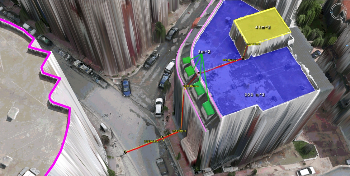
Virtual Surveyor Tools
What to do with those millions of triangles defining the geometry of an Urban Environment? Enter the Virtual Surveyor Tools. An all too often underestimated step in the workflow of a UAV mapping operation is the extraction of features of interest in vector format. Structure from Motion and Lidar give us unprecedented density in point […]
Continue reading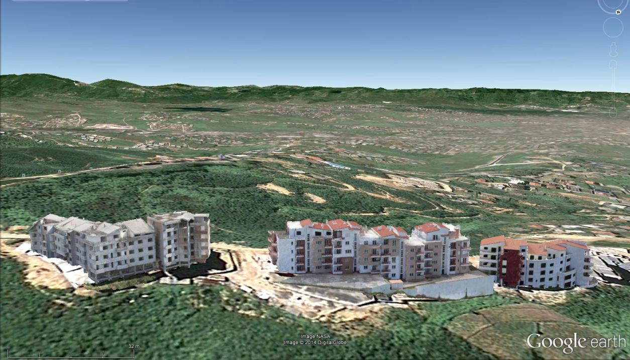
Mapping Urban Areas with UAVs
In case you missed our presentation on Mapping Urban Areas with UAVs at the annual meeting of the Florida Region ASPRS (American Society for Photogrammetry and Remote Sensing) last Friday, August 15th 2014, here is your opportunity to see it! The presentation covers some of our work in Albania where we used a SteadiDrone QU4D […]
Continue reading
UAV Mapping of Urban Areas
Presentation of UAV Mapping of Urban Areas….. Interested in UAV mapping of urban areas? Come and join the annual meeting of the Florida Region ASPRS (American Society for Photogrammetry and Remote Sensing) on Friday, August 15, 2014, in Ponte Vedra, Florida. We (Walter and Oliver Volkmann of Micro Aerial Projects) will be presenting some of […]
Continue reading