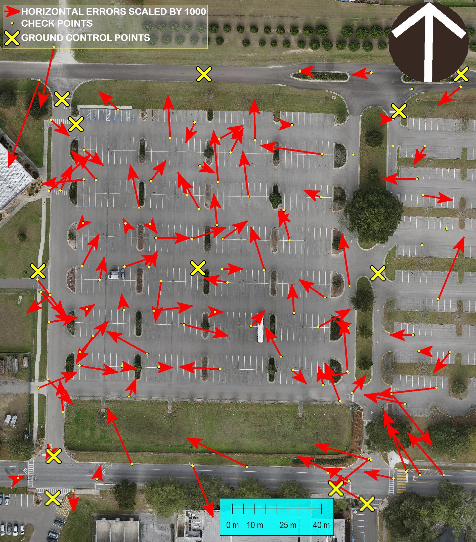
Accurate Surveying with Small Unmanned Aerial Systems and V-map The V-Map team is always concerned about accuracy of their work. In this photo we show a comparison between GPS and Ortho Photo coordinates of 105 check points. The ortho photo was produced from 261 24MP aerial images with a GSD (Ground Sampling Distance) of 13mm. […]
Continue readingYearly Archives: 2015
Surveying with drone2GIS Inc.
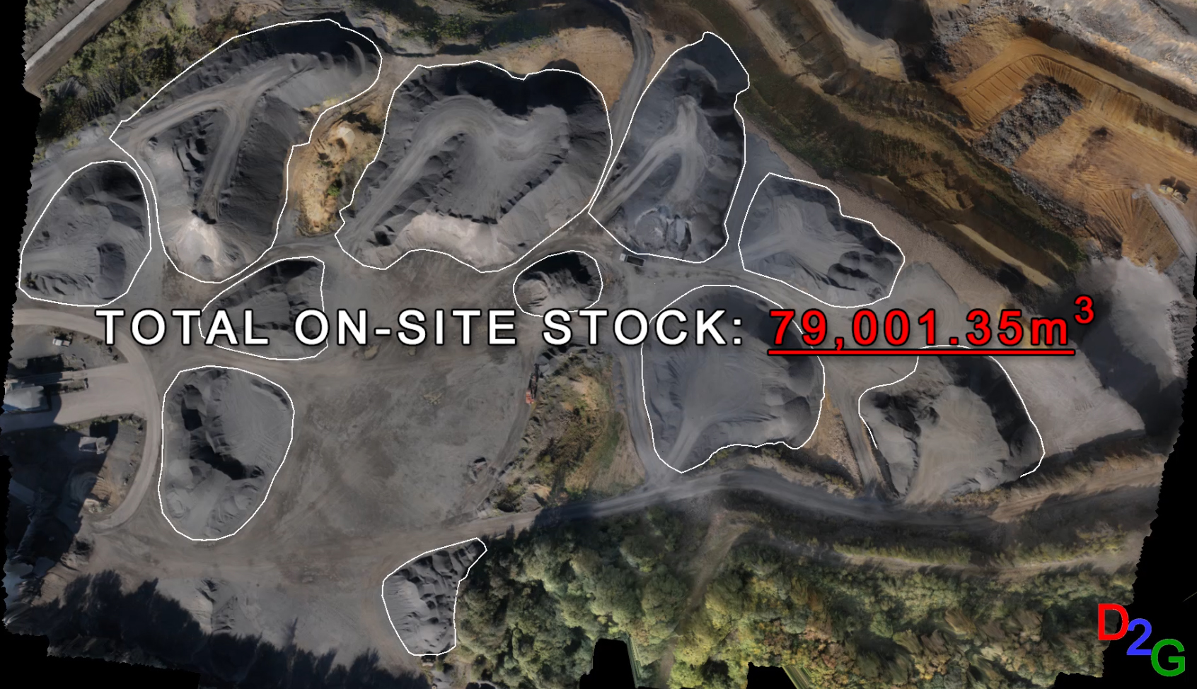
Drone2GIS offers a safe, efficient and accurate alternative approach to the conventional surveying method employed in open cast mines, quarries and stock yards for data acquisition. Through the employment of Unmanned Aerial Systems, Drone2GIS delivers precise, high accuracy ortho-photos, digital terrain models and virtual realities. With these products, we can extract features and positions to […]
Continue reading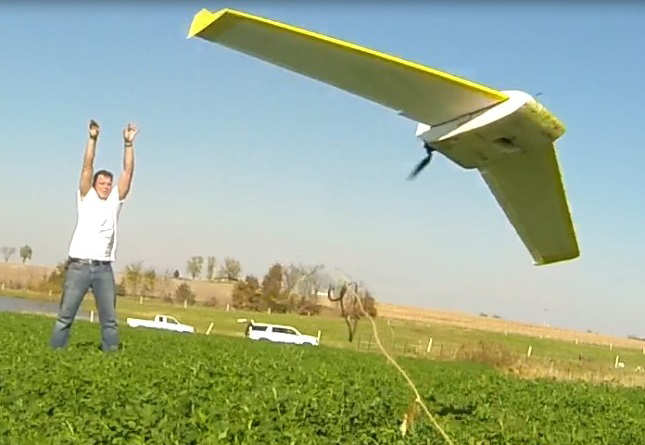
The new map
Micro Aerial Projects had the pleasure of working on this project with drone2GIS. Take a look at this video in which you will see how we are changing the geospatial product landscape! Sit back, relax and experience the new mapping standard as we take you through an example of drone2GIS Inc‘s work in an agricultural […]
Continue reading