
A new species recently sighted in the American skies… Name: Bateleur (belongs to the Pixhawk family) Color: White with yellow wingtips, distinctive black spot on chest Habitat: Over fields, farms and towns anywhere on the North American Continent Flight Characteristics: Flies automatically in straight lines and graceful circles Call: Faint humming with occasional beeps Habits: […]
Continue readingCategory Archives: Aerial Video
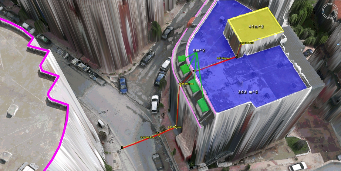
Virtual Surveyor Tools
What to do with those millions of triangles defining the geometry of an Urban Environment? Enter the Virtual Surveyor Tools. An all too often underestimated step in the workflow of a UAV mapping operation is the extraction of features of interest in vector format. Structure from Motion and Lidar give us unprecedented density in point […]
Continue reading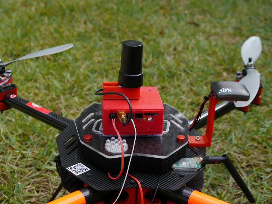
The new 20Hz version of our V-Map precise aerial mapping system has been released!
We have just delivered the first two units of the new 20Hz version of our V-Map precise aerial mapping system to a UAV mapping company in the USA. With dual frequency GPS observation rates as high as 20Hz, the V-Map system provides ultra-high accurate drone flight trajectories and camera exposure positioning. It weighs […]
Continue reading
Dispatch from Tirana, Albania
We at Micro Aerial Projects are very happy to continue our work with the World Bank in Albania where we are mapping and modelling with small UAVs. Today we completed our 49th flight over the quickly developing peri-urban landscapes on the fringes of Tirana. It all went without a hitch. We are really excited about […]
Continue reading