The National Mapping and Resource Information Authority (NAMRIA) of the Republic of the Philippines has certified and registered V-Map receivers as suitable for “first order geodetic control positioning”.
It is not with surprise, but with considerable pride that we share with you the news that the National Mapping and Resource Information Authority (NAMRIA) of the Republic of the Philippines has certified and registered our V-Map receivers as suitable for “first order geodetic control positioning”.
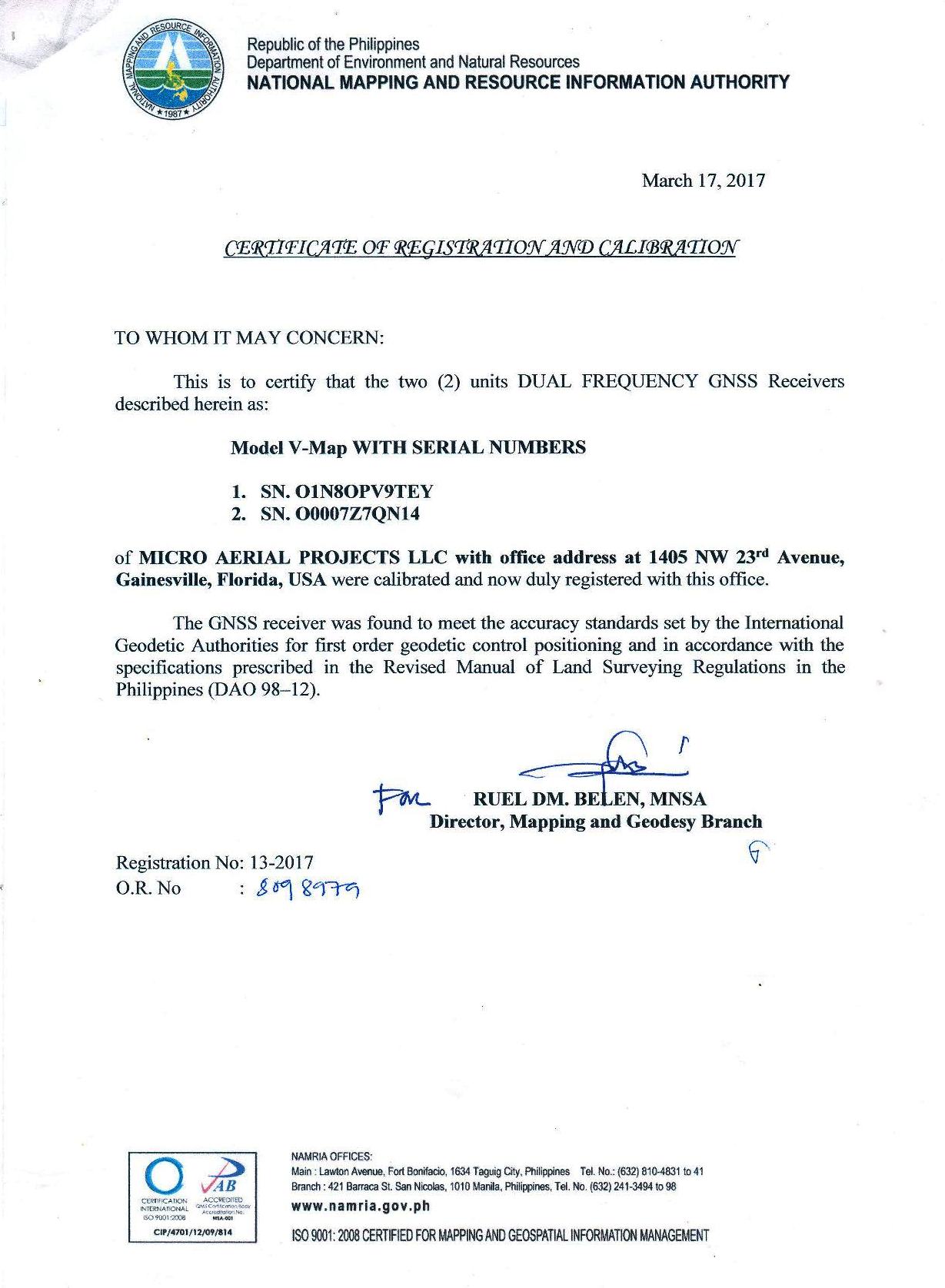 (Certificate of Registration and Calibration issued for V-Map receivers by the National Mapping and Resource Information Authority (NAMRIA) of the Republic of the Philippines.)
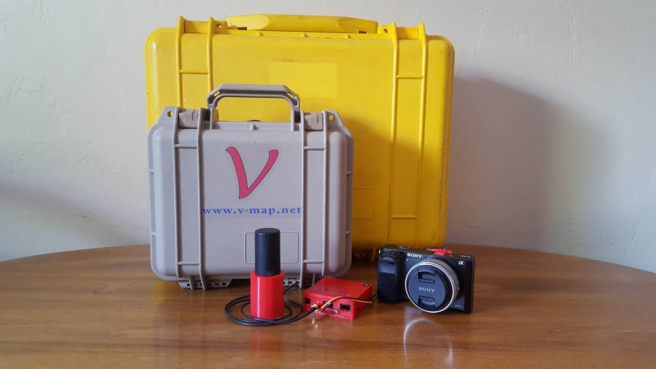
(Packing 20Hz dual frequency phase GNSS base and rover V-Map technology into a case a quarter the size for one main brand conventional GNSS rover)
We have become used to looks of skepticism from people, including seasoned professionals, who see our trusted V-Map receiver for the first time. “No way”, they say in genuine disbelief, “can a small box like that little red V-Map receiver perform as well as my ‘survey grade’ receiver, and at that price! C’mon, get out of here!”, they exclaim. No wonder. The survey instrument industry has for too long been domineered by supply driven, expensively packaged “solutions” bundled with lots of unwanted and superfluous functionality, overpriced accessories, proprietary barriers and spoon-fed, rigid procedures.
The V-Map receiver is the product of decades of real, practical GNSS surveying experience. It has been stripped from all unnecessary trappings to become a truly fit for purpose, universal GNSS measurement device. Yet it does not compromise on the essentials: highest quality 20Hz dual frequency phase tracking for operational robustness, connectivity for a wide range of hybrid survey applications including event marking, 1 PPS timing, RTCM streaming and RTK upgradeability with weight and cost factors suitable for all walks of life, from beginner to senior in the surveying and mapping business.
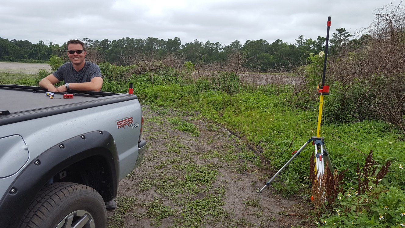 (When it comes to practical plug and map applications, whether as reference station or on moving platforms, V-Map provides the geo-spatial backbone.)
The flexibility and accuracy of the V-Map system have made it the first choice for precise geo-referencing in drone based Structure from Motion (SfM) mapping by surveyors all over the world who are using the V-Map system for purposes such as geodetic control network densification, drone based cadastral surveying, topographic mapping, Ground Control Point surveys as well as validation surveys.
 (The V-Map approach is ideal for drone mapping as shown here during a cadastral surveying exercise in Cordova in the Cebu province of the Philippines.)
We trust that these little red boxes will continue to find many innovative fit-for-purpose geo-spatial applications in the Philippines and elsewhere.
If you are interested in reliable, flexible, accurate and economic survey performance, feel free to contact us at info@microaerialprojects.com. We’d be delighted to answer any questions you may have about the V-Map approach. More information at V-Map.