The National Mapping and Resource Information Authority (NAMRIA) of the Republic of the Philippines has certified and registered V-Map receivers as suitable for “first order geodetic control positioning”. It is not with surprise, but with considerable pride that we share with you the news that the National Mapping and Resource Information Authority (NAMRIA) of the […]
Continue readingCategory Archives: News
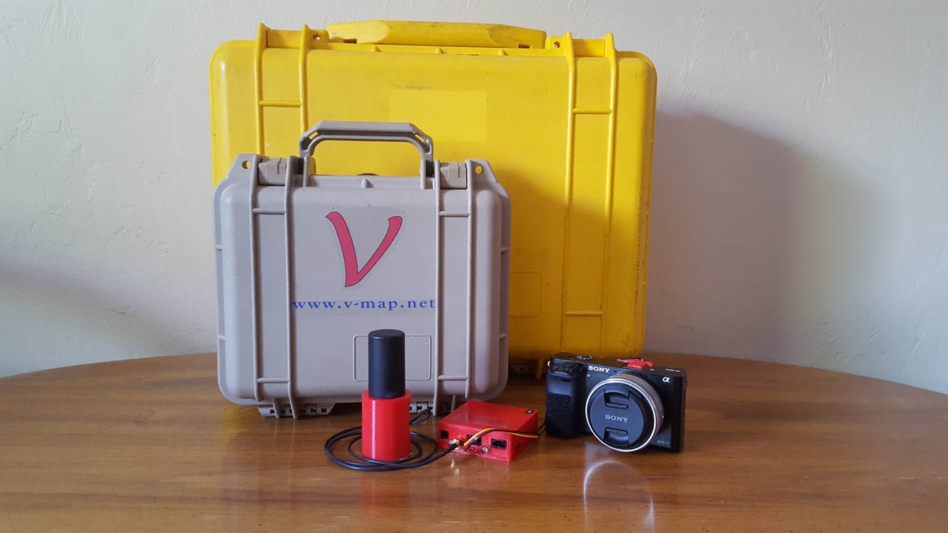
V-MAP AERIAL MAPPING SYSTEM ON THE TUFFWING UAV MAPPER
V-Map Aerial Mapping System on the TuffWing UAV Mapper In our continuing effort to improve on efficiency in Structure from Motion (SfM) mapping with small drones, we joined with Brian Christal of TuffWing to test the combination of the robust, no-nonsense UAV-Mapper with our dual frequency PPK GNSS V-Map System for a mapping technique […]
Continue reading
Drone Mapping Capacity Development – The Philippines
Walter Volkmann (CEO / Micro Aerial Projects L.L.C.) is currently in the Philippines providing Drone Mapping Capacity Development! Beneficiaries of this training include the Foundation for Economic Freedom (FEF), the Department of Environment and Natural Resources (DENR) and various other organizations and individuals. Using drones for mapping increases the efficiency and speed at which actionable data […]
Continue reading
Making maps with Small Drones – 5 Steps
Until very recently the acquisition of aerial imagery was very expensive as it could only be done by manned aircraft or satellites equipped with special cameras or sensors. The high safety risks, operational complexity and acquisition and operational costs of these mapping techniques made them completely uneconomic for small projects such as mapping a single village or […]
Continue reading
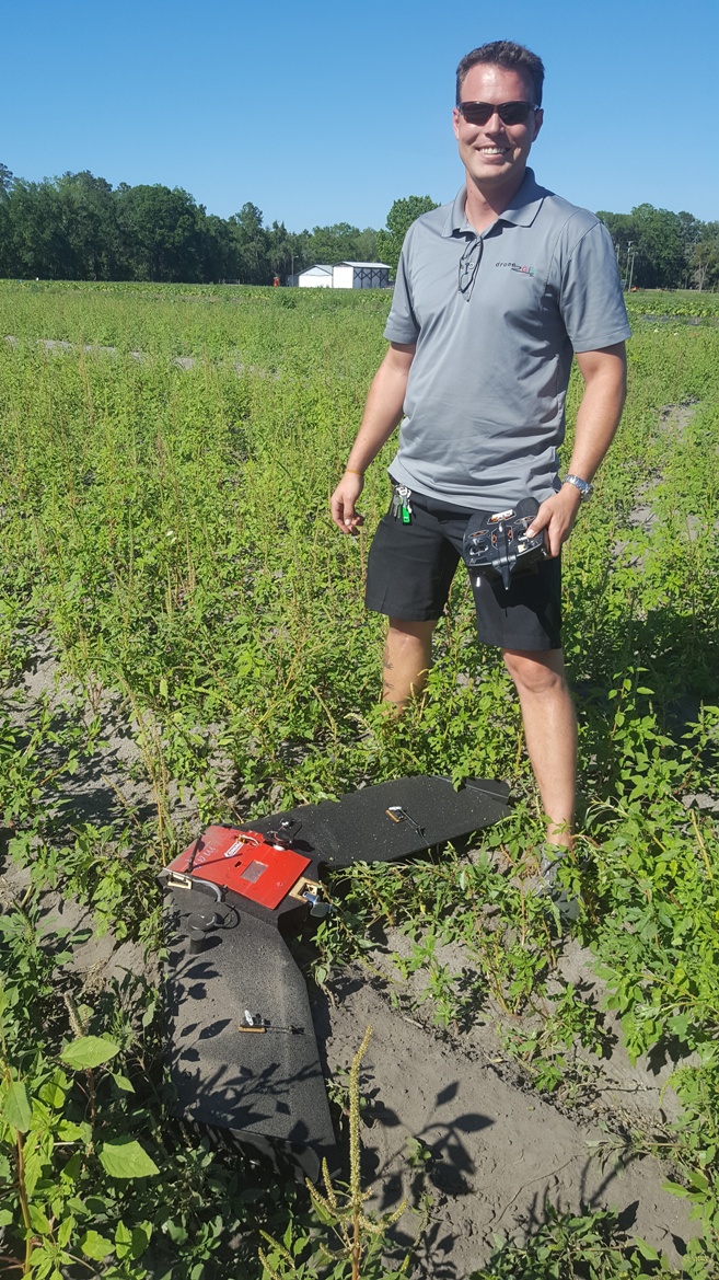
SNEAK PREVIEW OF A NEW SPECIES RECENTLY SIGHTED IN THE AMERICAN SKIES
A new species recently sighted in the American skies… Name: Bateleur (belongs to the Pixhawk family) Color: White with yellow wingtips, distinctive black spot on chest Habitat: Over fields, farms and towns anywhere on the North American Continent Flight Characteristics: Flies automatically in straight lines and graceful circles Call: Faint humming with occasional beeps Habits: […]
Continue reading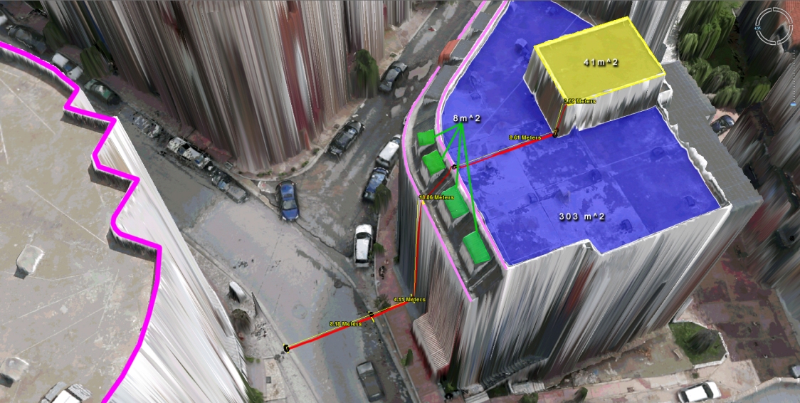
Virtual Surveyor Tools
What to do with those millions of triangles defining the geometry of an Urban Environment? Enter the Virtual Surveyor Tools. An all too often underestimated step in the workflow of a UAV mapping operation is the extraction of features of interest in vector format. Structure from Motion and Lidar give us unprecedented density in point […]
Continue reading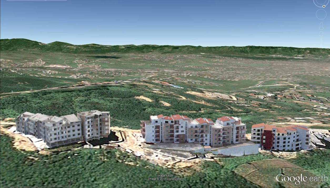
Mapping Urban Areas with UAVs
In case you missed our presentation on Mapping Urban Areas with UAVs at the annual meeting of the Florida Region ASPRS (American Society for Photogrammetry and Remote Sensing) last Friday, August 15th 2014, here is your opportunity to see it! The presentation covers some of our work in Albania where we used a SteadiDrone QU4D […]
Continue reading
UAV Mapping of Urban Areas
Presentation of UAV Mapping of Urban Areas….. Interested in UAV mapping of urban areas? Come and join the annual meeting of the Florida Region ASPRS (American Society for Photogrammetry and Remote Sensing) on Friday, August 15, 2014, in Ponte Vedra, Florida. We (Walter and Oliver Volkmann of Micro Aerial Projects) will be presenting some of […]
Continue reading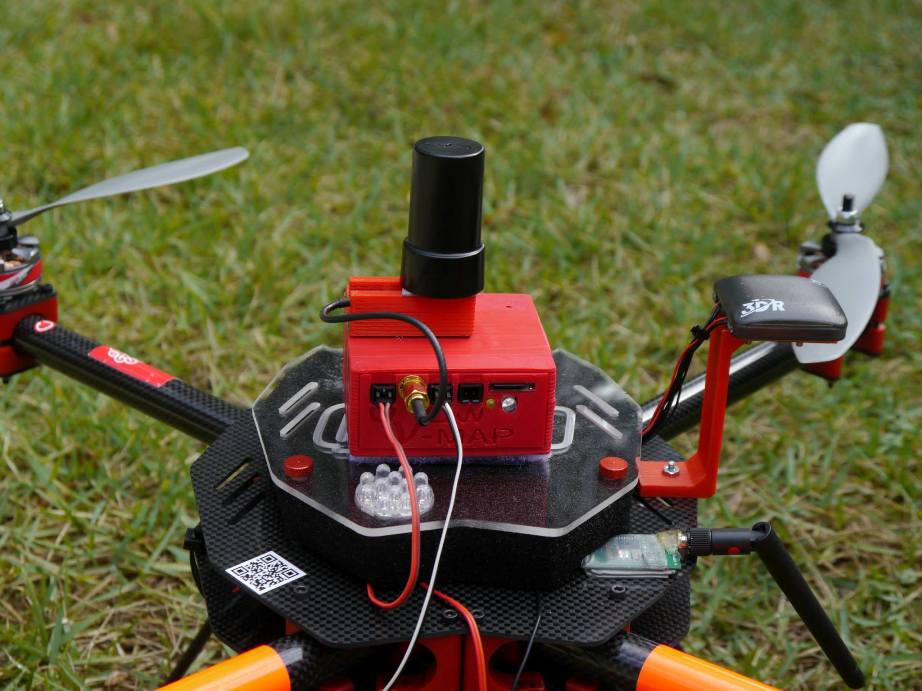
The new 20Hz version of our V-Map precise aerial mapping system has been released!
We have just delivered the first two units of the new 20Hz version of our V-Map precise aerial mapping system to a UAV mapping company in the USA. With dual frequency GPS observation rates as high as 20Hz, the V-Map system provides ultra-high accurate drone flight trajectories and camera exposure positioning. It weighs […]
Continue readingNews and Views from Micro Aerial Projects
Welcome! On this page you will find a digest of News & Views from Micro Aerial Projects and the V-Map System, wherever we happen to be in the world and on whatever project we may be working. Follow us as we continue developing optimal, efficient and cost effective geospatial solutions for a multitude of applications. […]
Continue reading